Tamil Nadu 12th Geography Model Question Paper 2026 has been published by DGE TN. You can now download the TN HSC (+2) Geography Sample Paper PDF to prepare for your exam. This Tamil Nadu Board Class 12 Model Paper includes specimen questions for the Geography subject based on the latest syllabus and blueprint. By practicing with the TN Class 12 Model Paper for Geography, you can aim to score full marks in the Tamil Nadu 12th Public Exam 2026.
தமிழ்நாடு போர்டு வகுப்பு 12 Geography மாதிரி வினாத்தாள் 2026 உங்கள் 12 ஆம் வகுப்பு போர்டு தேர்வுகளுக்குத் தயாராவதற்கு உதவும் வகையில் வெளியிடப்பட்டுள்ளது. நீங்கள் இப்போது HSC (+2) Geography மாதிரி பேப்பர் PDF ஐ இங்கிருந்து aglasem.com இல் பதிவிறக்கம் செய்யலாம். 12 ஆம் வகுப்பின் சமீபத்திய DGE TN பாடத்திட்டத்தின்படி மாதிரித் தாளில் மாதிரி கேள்விகள் உள்ளன Geography. எனவே நீங்கள் இந்த வினாத்தாளைத் தீர்த்தால், 12 ஆம் வகுப்பு Geography தேர்வில் 100% மதிப்பெண்கள் பெறுவதற்கான வாய்ப்புகளை மேம்படுத்துகிறது.
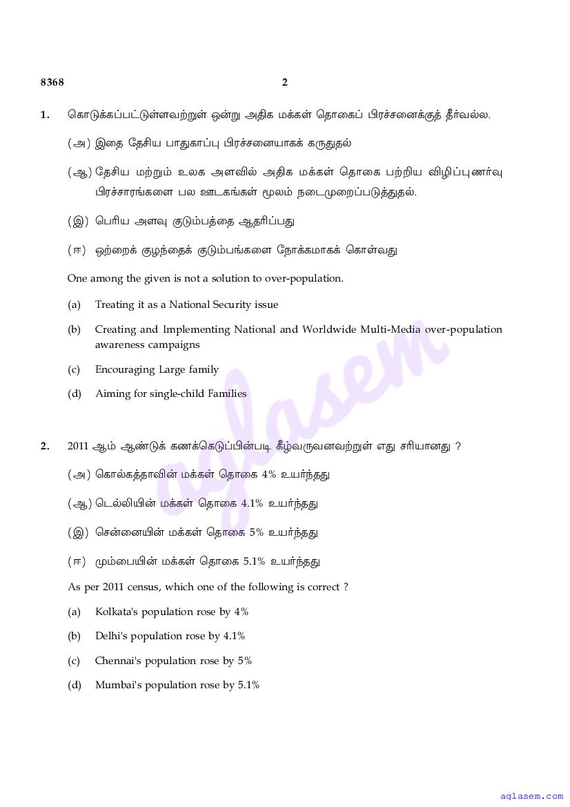
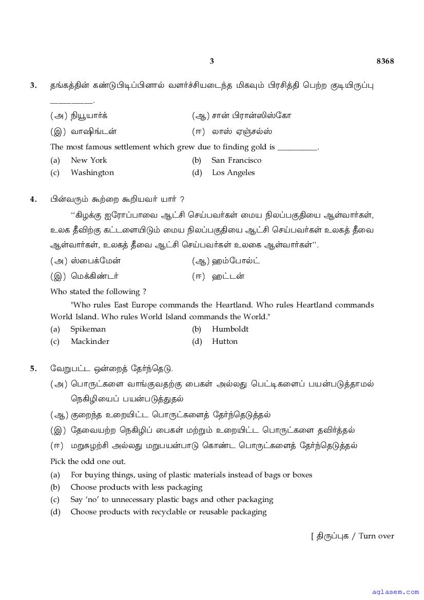
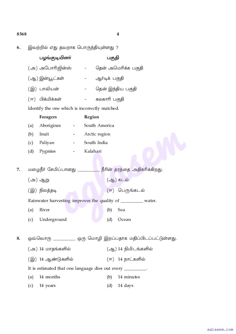
Tamil Nadu 12th Geography Model Question Paper 2026
The Tamil Nadu Board Model Paper for class 12 Geography is as follows.
Tamil Nadu 12th Geography Model Question Paper Download Link – Click Here to Download Question Paper PDF
Tamil Nadu 12th Geography Model Question Paper 2026 PDF
The entire question paper is as follows.
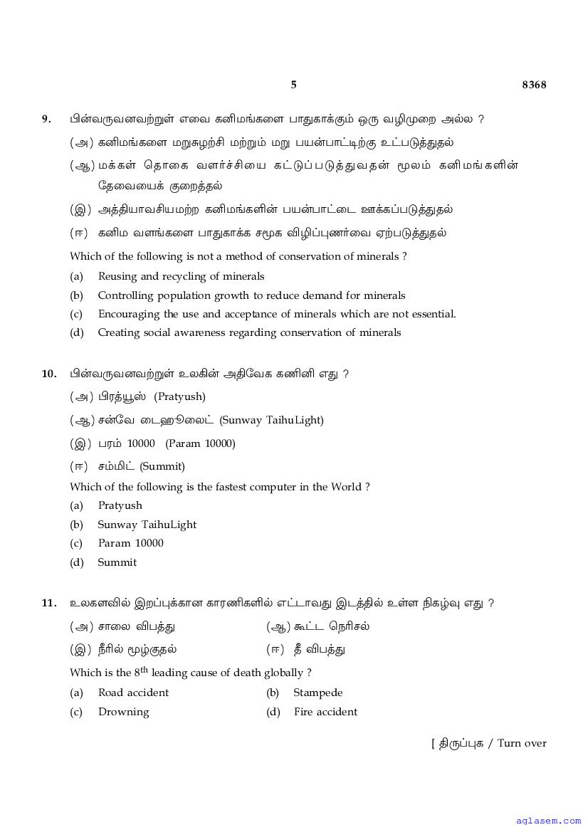
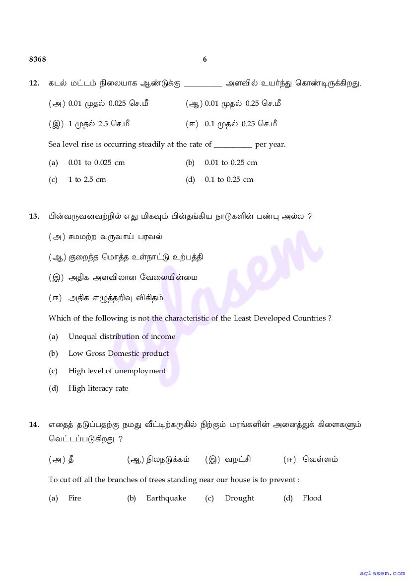
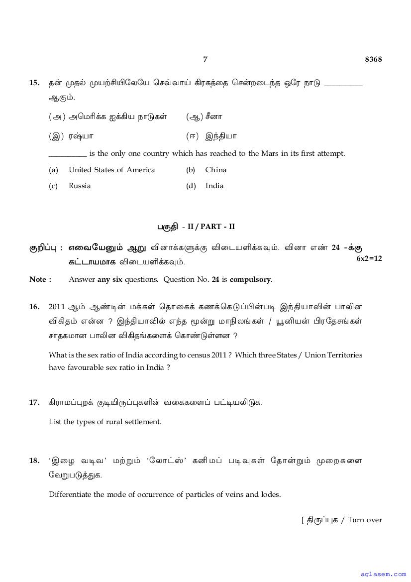
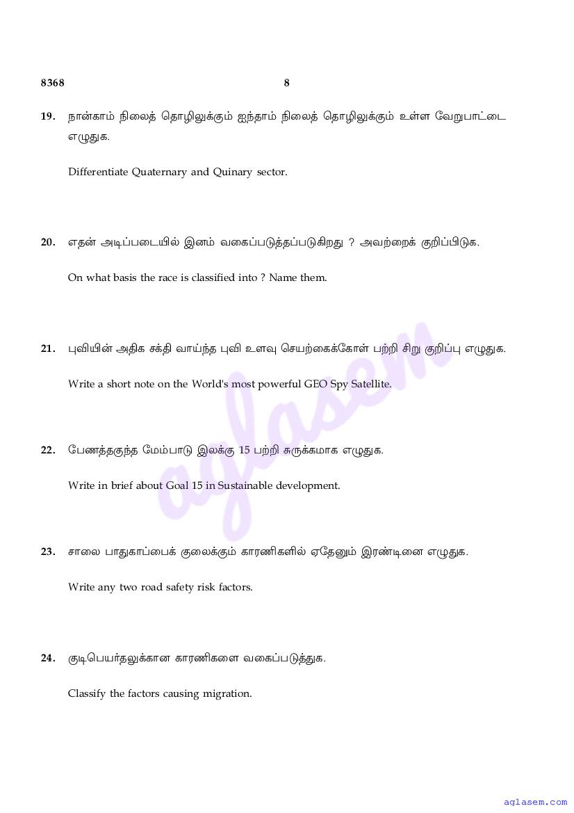
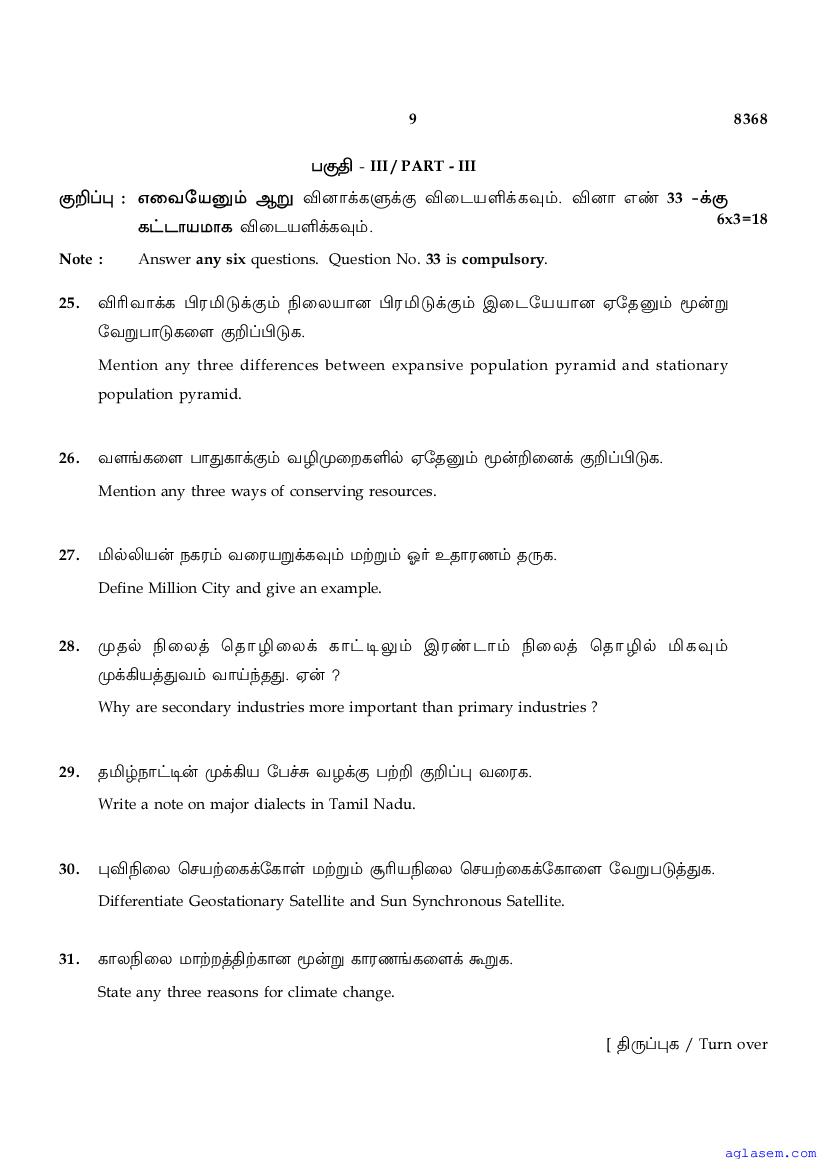
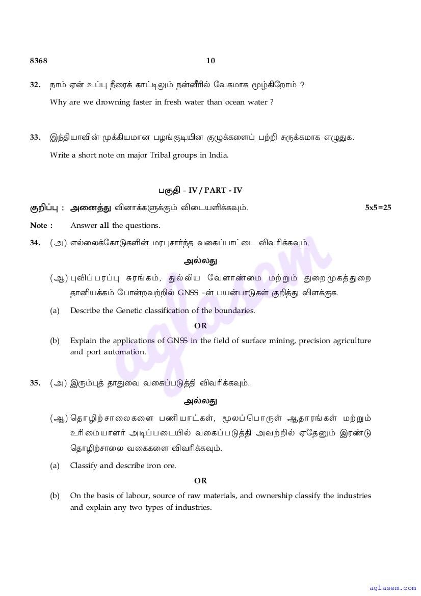
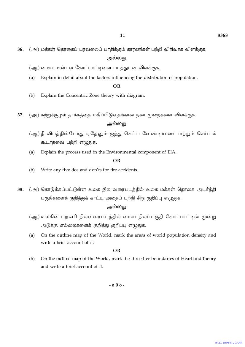
Tamil Nadu 12th Std Model Question Paper 2026 Geography View Download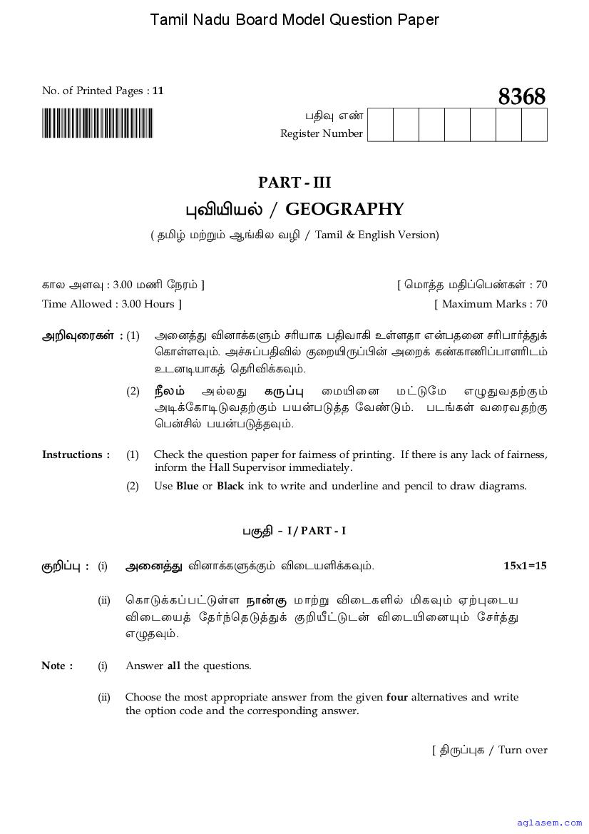
TN Class 12th Model Question Papers 2026
To ace the HSC (+2) exams, you need good marks in subjects besides Geography too. Therefore here are all the sample question papers for Tamil Nadu Board class 12.
- Accountancy
- Arabic
- Biochemistry
- Biology
- Botany
- Business Maths
- Chemistry
- Commerce
- Computer Application
- Computer Science
- Economics
- English
- English Communicative
- Ethics & Indian Culture
- French
- Geography
- German
- Hindi
- History
- Home Science
- Kannada
- Malayalam
- Maths
- Microbiology
- Nursing
- Nutrition & Dietetics
- Physics
- Political Science
- Sanskrit
- Statistics
- Tamil
- Telugu
- Urdu
- Zoology
- Vocational Subjects (All)
Tamil Nadu Board Model Papers
The class-wise sample papers for Tamil Nadu board are as follows.
Tamil Nadu 12th Geography Model Paper 2026 – An Overview
The key highlights of this study material for Tamil Nadu 12th Public Exam 2026 is as follows.
| Aspects | Details |
|---|---|
| State | Tamil Nadu |
| Class | Class 12 / HSC (+2) |
| Subject | Geography |
| Study Material Here | Tamil Nadu Board Model Question Paper for Class 12 Geography |
| More Sample Papers for This Class | Tamil Nadu Board Model Question Paper for Class 12 |
| More Sample Papers for This Board | Tamil Nadu Board Model Question Papers |
| Name of Education Board | DGE TN (Directorate of Government Examinations Tamil Nadu) |
| Previous Year Question Papers | Tamil Nadu Board Class 12 Question Papers |
| Exam Dates | Tamil Nadu Board Class 12 Time Table |
| Result | Tamil Nadu Board Class 12 Result |
If you have any queries on Tamil Nadu 12th Geography Model Question Paper 2026, then please ask in comments below.
To get study material, exam alerts and news, join our Whatsapp Channel.